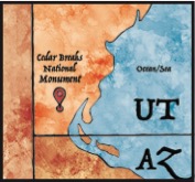
The rocks of Cedar Breaks National Monument reveal
the powerful forces of geologic change that have created the canvas upon which
today’s remarkable landscape is painted. Standing at the rim of Cedar Breaks
amphitheater, you gaze into a high-altitude wonderland of colorful cliffs and
pinnacles. Yet the rocks tell stories of ancient seas, violent volcanoes, and a
time when a visitor to Cedar Breaks would have found themselves afloat in a
body of water the size of modern-day Lake Erie.
 |
| Late Cretaceous- 90 Million years ago |
 |
| Eocene- 50 Million years ago |
Lake Claron Utah’s First Great Lake: By the end of
the Cretaceous, the sea had retreated and the Rocky Mountains were beginning to
rise to the east. Now surrounded by mountains on all sides, Southwest Utah
became a closed basin home to ancient Lake Claron. By about 60 million years
ago, streams were bringing sand, silt and mud into Lake Claron, where it
settled to the lake bottom. Small organisms like snails fed in the muddy ooze,
adding their calcareous skeletons to the detritus upon their death. Trace
amounts of iron in the sediment would combine with oxygen and water, “rusting”
many of the layers into warm red, orange, and pink hues. These processes
continued for millions of years, gradually filling the basin. During wet
periods, the lake level would rise. During dry periods, the lake level would
fall. Ancient soils preserved between the rock layers suggest that at times the
lake would dry up entirely. This constantly (but gradually) changing climate over
~25 million years created the many intricate and vibrantly colored layers of
the Claron Formation, the most prominent rock layer at Cedar Breaks and nearby
Bryce Canyon.
 |
| Early Miocene- 20 Million years ago |
An Explosive Landscape: A suite of volcanic rocks above the rim of the
amphitheater point to the arrival of violent and turbulent times, just as the
days of the tranquil Lake Claron were ending about 35 million years ago. Soft grey rock near
North View and on the lower slopes of Brian Head Peak belongs to the Brian Head
Formation. This layer contains material erupted from volcanoes to the west near
the Utah/Nevada border (more than 60 miles away) as well as sediment that
settled to the bottom of the dwindling lake. These volcanic eruptions, among
the largest in Earth’s history, sent pyroclastic flows (hot clouds of ash,
volcanic gasses, and molten rock fragments) racing across the landscape. These
flows form a volcanic rock called tuff; good examples are the Leach Canyon and
Isom Formations found near the summit of Brian Head Peak.